
Huntington ZIP Code Directory Coverage
Huntington is served by a set of postal areas that overlap Huntington hamlets, incorporated villages, and places beyond the Town. The Huntington inventory below reconciles the Suffolk County 1975 catalog, the County ZIP map, Town geography, and USPS location information. It is a starting set for research, not a parcel boundary file. The address itself still needs a USPS check and a Town GIS or tax-map confirmation.
| ZIP | Areas Covered | Post Office | Notes |
|---|---|---|---|
| 11721 | Centerport | Centerport Post Office | Town place; verify each address with USPS |
| 11724 | Cold Spring Harbor | Cold Spring Harbor Post Office | Some surrounding geography lies outside the Town |
| 11725 | Commack | Commack postal area | Partial Town coverage; do not assign by postal code alone |
| 11731 | East Northport | East Northport postal area | Town place and postal area |
| 11740 | Greenlawn | Greenlawn Post Office | Town place with a documented USPS service reference |
| 11743 | Huntington and Halesite | Huntington and Halesite offices | Postal label does not prove village status |
| 11744 | Huntington box mail | Historical box-mail entry | Not a normal physical-address assignment |
| 11745 | Halesite | Halesite Post Office | USPS and County material identify Halesite service |
| 11746 | Huntington Station and Dix Hills | Huntington Station Post Office | Large postal area; only some addresses are in the Town |
| 11747 | Melville and Huntington Station Annex Area 2 | Melville/Huntington Station postal area | Shared geography; verify the parcel and municipality |
| 11748 | Huntington Station box mail | Historical box-mail entry | Not a normal physical-address assignment |
| 11749 | Melville | Melville postal area | Postal area can overlap other local geography |
| 11768 | Northport and Fort Salonga | Northport postal area | Fort Salonga extends beyond Huntington |
Two historic Huntington box-mail entries, 11744 and 11748, deserve special care because the County catalog does not present them as ordinary physical-address assignments. The County's map also says it is subject to revision and is not for surveying or conveyance. That caution matters most in shared Huntington areas such as Commack, Huntington Station, Melville, Northport, and Fort Salonga.
Huntington Postal Label Checks
The USPS ZIP Code Lookup has two separate tools for a Huntington search: address to ZIP, and city/state to all ZIPs. The first confirms the mailing code for a supplied Huntington address. The second returns postal codes associated with the entered place. USPS specifically warns that its result does not confirm that a person or company is at an address, so it should never stand in for a parcel or identity check.
The USPS lookup interface is shown in the source image below.
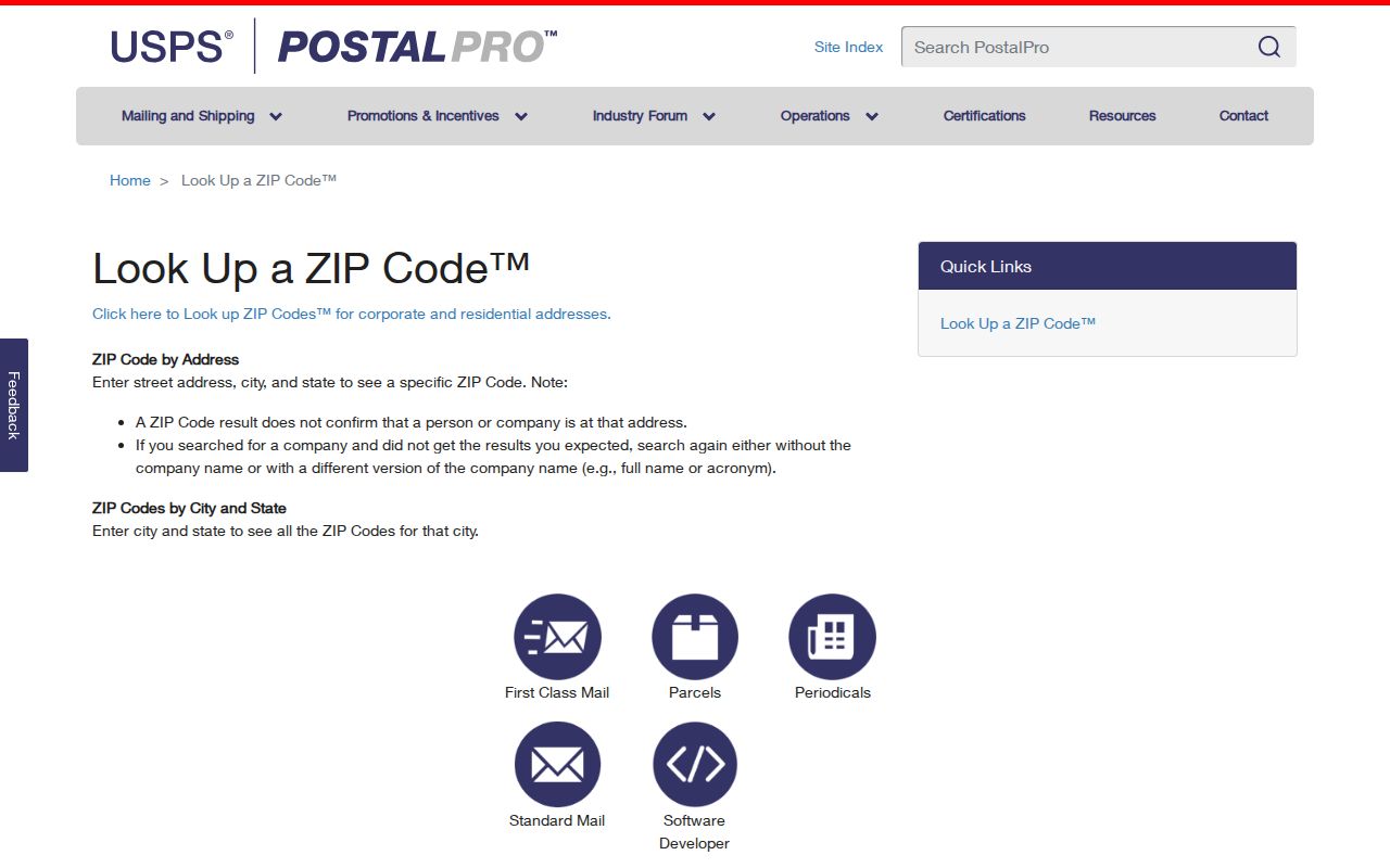
USPS location pages document Huntington, Halesite, Huntington Station, Centerport, Cold Spring Harbor, Greenlawn, and Melville service locations. Those are Huntington postal references. Pair the result with the street address and SCTM before describing the jurisdiction of a Huntington parcel.
Finding Residents in Huntington ZIP Areas
A Huntington postal code can narrow a question, but the available record systems use it in different ways. USPS verifies the mailing code. The Huntington GIS identifies a specific parcel through address, SCTM, or intersection searches. The State license search can filter public credentials by city, county, and postal code, while the voter form uses a ZIP only as part of a known-person query. None is a complete Huntington household list.
- Use the USPS address tool to verify the mailing code for the Huntington address in hand. Record the result date because postal assignments and reference maps can change.
- Search the Huntington Property Tax Record or Huntington GIS by street address and preserve the SCTM. That establishes the parcel-linked reference point.
- Use the relevant Huntington record system for the narrower question. A license search can filter a public credential, while a Clerk search can connect the parcel to recorded instruments.
- Compare the Huntington physical address, mailing address, village or hamlet label, and source date before retaining a result. If the goal shifts to a named street, use the Huntington street directory for the address-level workflow.
A Huntington ZIP-wide result can be too broad for a shared postal area. The safer endpoint is a specific Huntington address validated by USPS and then checked against the Town's parcel system. That sequence also avoids treating a mailing label as proof of a person's presence.
Huntington License and Parcel Filters
Search controls reveal the purpose of a Huntington database. The NYS Department of State licensee search accepts name, license type, county, city, and ZIP fields. It can return an identifier, name, city, type, and expiration, but it excludes residence addresses. The Huntington Town and County systems take a different route: they are strongest when a street address or SCTM is already known.
| Source | Postal or address input | What the result can support |
|---|---|---|
| USPS lookup | Huntington address to postal code; city/state to all codes | Huntington mailing-label verification, not person or parcel proof |
| Huntington Property Tax Record | Street number, street name, or segmented tax-map fields | Huntington property-linked owner, physical address, tax, and assessment fields |
| Huntington GIS | Huntington parcel address, SCTM, or intersection | Huntington parcel geometry, property-card links, districts, and map context |
| DOS licensee search | Last name, first name, type, county, city, and ZIP | Huntington public credential or affiliation, not residence |
| NYS voter form | County, name, date of birth, and postal code | Known Huntington individual's registration or poll-site route |
The Suffolk County Clerk kiosk has an address-to-tax-map mode, Tax Map ID search, name search, and optional ZIP field for Huntington records. Its large result lists show only the first 2,000 rows. For a Huntington parcel with an uncertain street label, the 19-digit SCTM is the better bridge between the Town and County systems.
Huntington Postal Boundaries
A mailing city and a local government boundary are separate things. A Huntington Station postal label can be inside the Town without placing an address in Northport or Huntington Bay. A Northport label can involve the incorporated village, and Fort Salonga is not wholly within Huntington. Postal areas can also cross school, fire, village, and county legislative boundaries.
These terms keep a postal search from becoming a boundary claim.
- ZIP and ZIP+4
- A ZIP identifies a postal delivery area. ZIP+4 adds a smaller delivery segment and does not create a municipal boundary.
- Box-mail ZIP
- A postal code used for box-mail service rather than a normal physical-address assignment.
- Unique ZIP
- A code assigned for a single receiving organization or facility. The research did not identify a Huntington example to treat as a Town boundary.
- Carrier route
- A delivery sequence used by postal operations. It is not a parcel map or a list of people at addresses.
Huntington Village and Harbor Labels
Place names in Huntington have several layers. The Town includes the incorporated villages of Northport, Asharoken, Lloyd Harbor, and Huntington Bay, plus unincorporated places such as Halesite, Huntington Station, Greenlawn, Centerport, Cold Spring Harbor, East Northport, Melville, South Huntington, Elwood, Commack, Dix Hills, and Fort Salonga. A place name may appear in a postal address even when its boundary is not the same as the Town's.
Harbors, stations, villages, and district names are useful for finding the right records office or collection, but they should remain clearly labeled. Huntington has five harbors, four Long Island Rail Road stations, four incorporated villages, and eight school districts. School, library, fire, refuse, and village layers can help characterize a parcel's location without describing a postal area as a neighborhood boundary.
Huntington Postal Map Dates
Every postal list needs a date. The County's ZIP map says it is subject to revision, and the older County catalog has historical box-mail entries that do not answer a modern parcel question. In July 2025, USPS described investment in the Huntington Station Sorting and Delivery Center. That release concerns delivery infrastructure, not a change to Town or postal boundaries.
Keep the source date beside a result from a County map, a USPS tool, or an archival directory. A dated label can still be useful for family-history work, especially where old directories or maps use a hamlet name differently from a current mailing address. It should not be converted into a current location claim without a fresh parcel check.
Huntington ZIP Code Record Limits
The voter registration form cannot be used to browse a street or a postal area. It requires a known individual's county, name, date of birth, and ZIP, and confidential registration can keep a qualifying voter's residence address separate from a public record. A missing result does not authorize a searcher to recreate a protected address from maps, deeds, or unrelated sources.
Likewise, the Town GIS includes owner-mail and resident-mail reports as part of its public-data model, but a report label is not a verified household census. Use the smallest field set that answers the question. Do not publish sensitive identifiers, full dates of birth, signatures, protected addresses, or raw voter data.
Huntington Parcel Validation
The most reliable final check follows a short chain: postal address, Town GIS or tax record, SCTM, then County Clerk instrument when the question concerns a recorded transfer. The GIS accepts a parcel address, SCTM, or intersection and can expose property-card links, district layers, and reports. Its own disclaimer says it is a reference tool, not official survey information.
For a deed, preserve the Liber, page, document type, grantor, grantee, date received, legal description, and access date. A subdivision, merger, old map reference, or metes-and-bounds description can explain why a prior record uses a different street label. Postal research is most useful when it leads to this parcel-level confirmation rather than replacing it.